HIKING GUIDE: MOUNT BADEN - POWELL
ANGELES NATIONAL FOREST, CALIFORNIA

I first learned of Mt Baden-Powell last summer while scoping out the Six Pack of Peaks Challenge.
If you have never heard of it before, the Six Pack of Peaks is a challenge to hike six iconic SoCal mountains in one season. With our lack of camping this season, I had ambitions to get more into day hiking, and this felt like the perfect motivator. As icing on the cake, I love exploring SoCal and checking boxes, so signing up felt like a no-brainer.
However, up until this point, my hiking had been pretty sporadic. Mostly local hikes around LA and then where ever we went camping…the Sequoias, Joshua Tree, etc… Noting that, and after much research, I concluded that Mt Baden Powell was a good choice for my first peak. Although I believe there is another route to summit, this guide will take us via the Vincent Gap trailhead.
The Deets:
THE MOUNTAIN:
Mt Baden Powell is named for Lord Baden-Powell, founder of the Boy Scouts. Summiting this mountain will bring you to a monument for its namesake along with sweeping 360 views of the San Gabriels. This is an out and back hike, notorious for its 40+ switchbacks, that will also take you on a piece of the Pacific Crest Trail.
ELEVATION:
9399’
LOCATION:
San Gabriel Mountains, Angeles National Forrest.
you will want to use this link to get to the trailhead Vincent Gap, CA, 93563, USA
PARKING:
Yes, you will need a Socal adventure pass displayed on your vehicle. We arrived after 8:30 AM and found a parking spot pretty easily. On our way out though it was packed! In the event that you arrive later in the day, I imagine enough people are coming and going that waiting around long enough will eventually yield a spot.
I purchased an Annual Adventure Pass from my local REI. You can also purchase a day pass for $5 from the rangers office or check out this whole list of locations-
https://www.fs.usda.gov/detailfull/r5/passes-permits/recreation/?cid=STELPRDB5181410&width=full
DISTANCE / TIME:
~ 8 miles roundtrip / 4-5 hours
DIFFICULTY:
Moderate to Hard
I’d like to note that levels of difficulty are going to be different for everyone! My sister and brother tagged along, neither whom are avid hikers. The 40+ switchbacks are no joke, but definitely doable if you take plenty of breaks and stay hydrated. Obviously, the way back down is a lot easier!

GETTING TO THE TRAILHEAD:
The Vincent Gap trailhead sits in the back of the San Gabriels. We left right before 7am from our apartment in Hollywood and arrived to the trailhead around 8:40AM. If you or anyone in your party has a sensitive stomach I might forgo the mountain views and go around the San Gabriels and hit Vincent Gap from the North. You will go through the little town of Wrightwood and still have a few twists and turns to get to the trailhead. The parking lot is pretty large, and you will see it pop up while looking for signage for the Pacific Crest Trail.
the hike:
Park your car, pop your Adventure Pass on your windshield and hit the trail! There are bathrooms right next to the trailhead, so I would use them, but also encourage you to have your own TP and hand sanitizer on hand. There are a few other trails that start from this location, you want to go to the right and follow signage for the Pacific Crest Trail. We snapped a pic of Kailey channeling her inner Reese Witherspoon next to this PCT sign on our way up.
The trail begins to incline almost immediately, and then you are on your way hiking up the 40+ switchbacks to the summit! There isn’t a whole lot to note in terms of directions, the trail is well trafficked, and we came across other hikers and even a handful of trail runners, which I thought was so cool. The trail is well marked to follow the switchbacks. Eventually you come to a barren saddle, which is the last stretch of hiking before reaching the peak. The saddle too offers some gorgeous views, and this very gnarly, knotted, and ancient looking tree.


Keep going up the last bit after that impossible to miss tree- you know you’ve made it to the top when you see the monument. There is also an American Flag. We took a few minutes to marvel at everything and ate our lunch. Everyone we met at the peak was super nice and we all took turns taking pictures of each other. The day we went was a tad cloudy and overcast, but we could still see well into the valley and San Gabriels.


TIPS & GEAR:
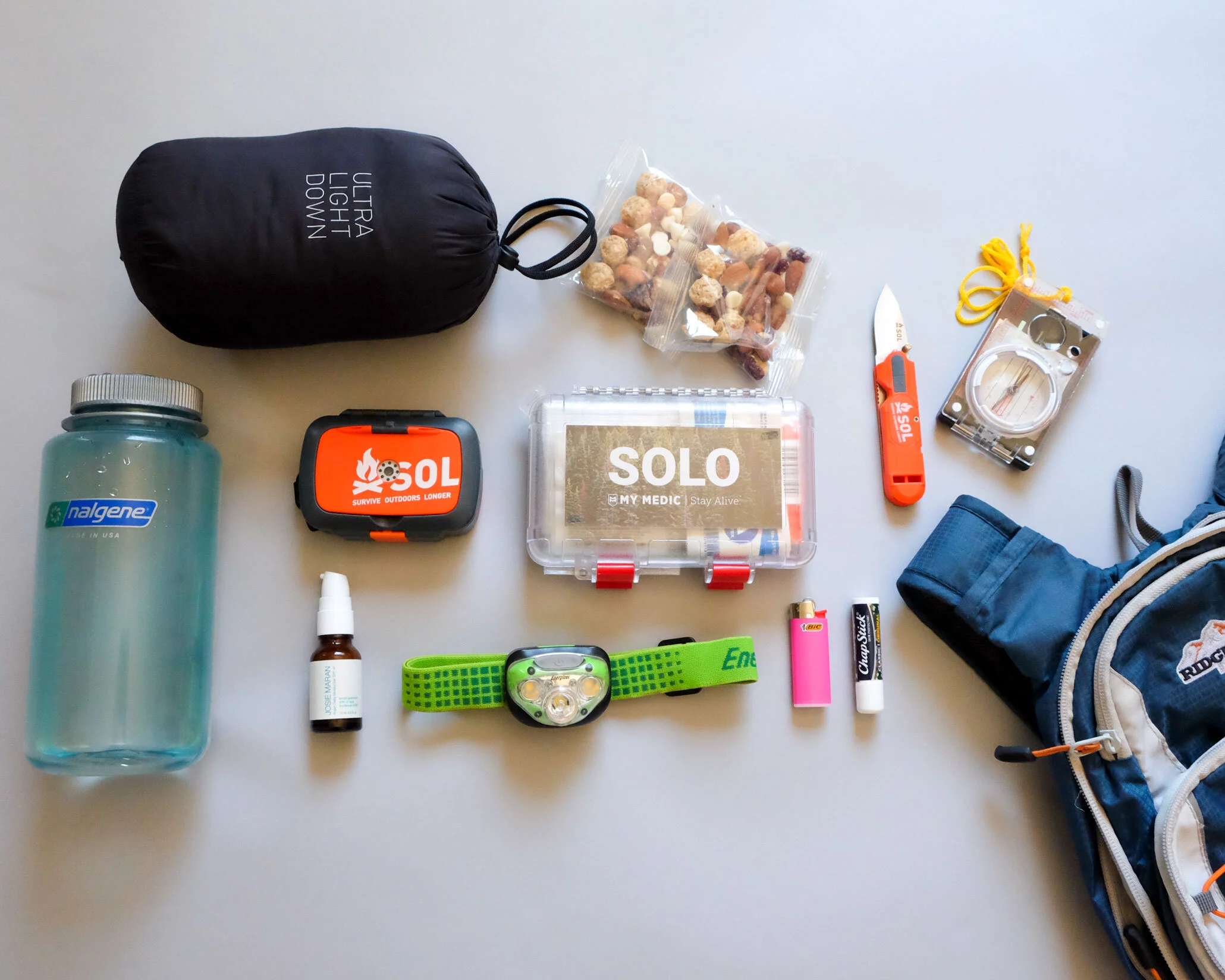
As always, for this and any hike, be sure to bring the 10 Essentials!
TREKKING POLES
If I were ever to do this hike again, I would absolutely bring trekking poles. No one in our party had them, and we were fine, but I think it might have made our trek more manageable.
HIKING BOOTS
Seems like some folks do this hike in sneakers, but this is not Runyon Canyon, this is a real hike and I would recommend wearing hiking boots.
WATER & FOOD
We each carried 3 liters of water, and I carried some extra in my backpack. This 2 liter hydration pack I was gifted has done the trick for countless day hikes the past 5 years! For the price, I am beyond happy with it.
Absolutely bring a lunch or at least a snack for the summit! You will need to refuel on this hike! We all devoured the apples, PB&J, and Cliff Bars we brought with. Something I have transitioned from my running life are Gu energy gels and chews. They’re so easy to take and for me, do a good job replenishing all the nutrients I lose getting up the mountain.
SUNSCREEN
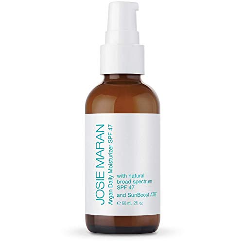
A majority of this hike is well shaded, but the farther up in elevation, the more the forest clears out and eventually you’re completely exposed. So wear sunscreen! My favorite natural sunscreen is Josie Maran’s SPF47
LAYERS
Starting in the early am it was slightly chilly, so I was happy to have a long sleeve shirt. Pretty quickly we built heat though and found ourselves shedding layers.


save this pin for later