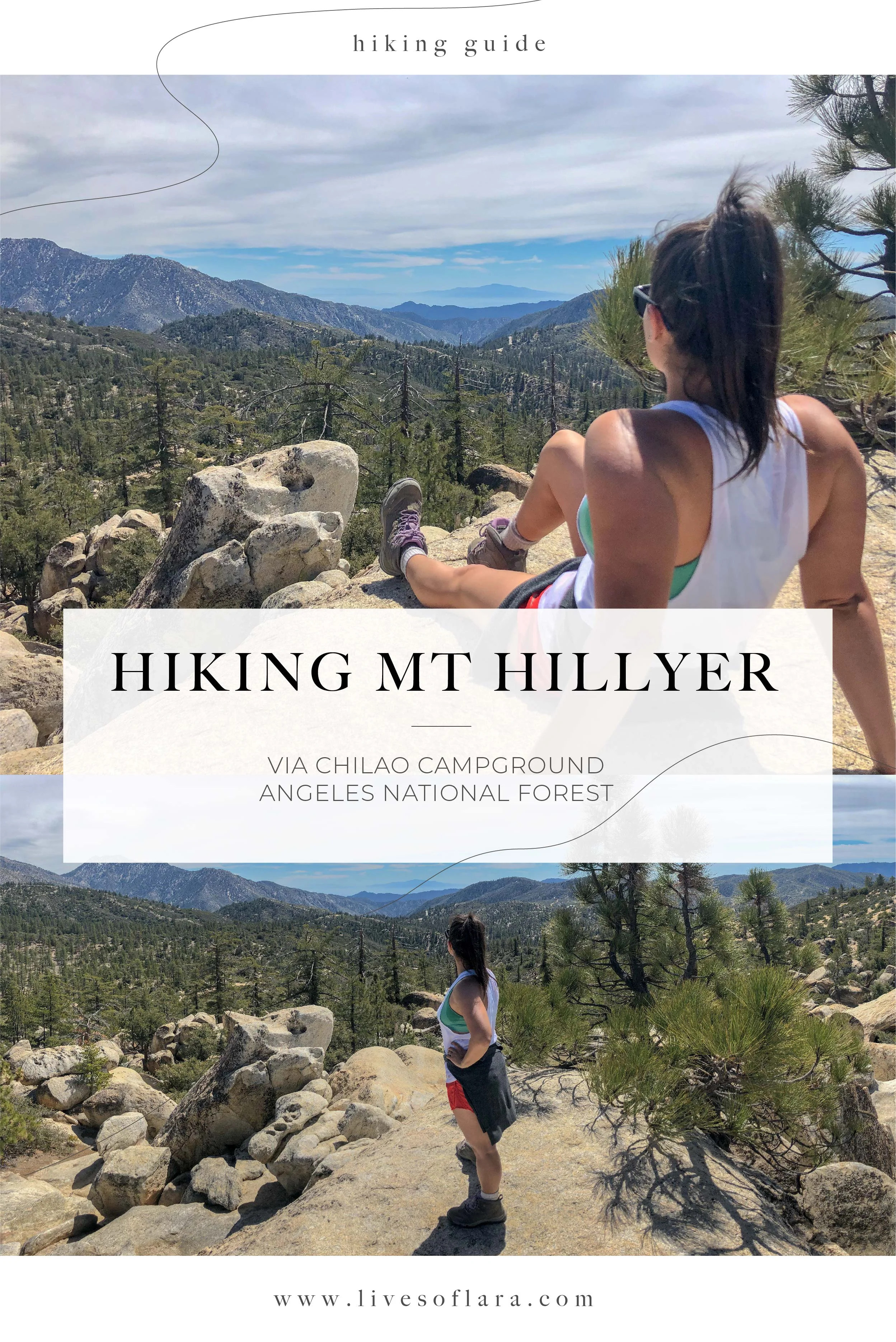
HIKING GUIDE: MOUNT HILLYER

We made Mt Hillyer an out and back hike while staying at Chilao Campground in Angeles Nat’l Forrest. You can read about that experience here.
We started from Chilao, but if you want a shorter hike you can start from Horse Flats Campground (as of this writing, Horse Flats is closed but technically still accessible).
From our actual site at Chilao we had approx a ¾ mile walk to the trailhead. It pops up right before you hit the Chilao Visitors Center. There are 4 or so parking spots right at the trailhead. The signage lists horse flats as 1 mile away.
The Deets:
THE MOUNTAIN: Mt Hillyer is one of the more doable peaks in the San Gabriels. You can access it via Horse Flats Campground, or you can start from Chilao Campground hiking part of the Silver Moccasin Trail, and this will add an additional mile. This hike will take you through views of Chilao up to Horse flats, were you continue an additional mile through some rocky boulders. For this hike we didn’t actually make it to summit. We sort of lost the trail! However, we did do some scrambling and enjoyed the views from the highest boulder we could find.
ELEVATION: 2600’
LOCATION: San Gabriel Mountains in Angeles National Forrest.
I’m going to list the Chilao Vistor’s Center for GPS to get to the trailhead. You will need to continue west past the visitor’s center about half a mile until you reach the trailhead. Chilao Visitor’s Center to Trailhead
PARKING: Yes, there are 4-5 spots you can park at the trailhead. You will need a Socal adventure pass displayed on your vehicle.
I purchased an Annual Adventure Pass from my local REI. You can also purchase a day pass for $5 from the rangers office or check out this whole list of locations
DISTANCE: ~ 4mi roundtrip
TIME: ~ 2 hours
DIFFICULTY: Easy-Moderate
I think this hike is totally doable. It wasn’t too steep, but footing can get a little iffy as you can tell lots of mountain bikers frequent the area, creating narrow dips in the trail.
getting to the trailhead:
This guide is going to take you to the trailhead via Chilao Campground. From the campground follow signage to the visitors center. I would say we walked about a half mile from camp to the trailhead. The trail will pop up on your left and you will see the signage below. If starting from camp and you reach the visitors center, you have gone about a half mile too far. If you are not camping at Chilao, then I would recommend putting the visitor’s center in your GPS and then keep going west about a half mile to park at the trailhead.
THE HIKE:
You’ll begin your hike as you ascend through piney forest. As you gain elevation there are great views of Chilao campground below.


Eventually we came to a fork in the trail. We could go to the right and continue on the Silver Moccasin Trail, but you want to go with the signage that takes you left towards Horse Flats and Mt. Hillyer. Entering Horse Flats campground, you can tell it seems to be going through some major renovations. I did not look it up, but I would say it suffered from fires and flooding. I’m not sure when Horse Flats will reopen. We followed the continued signage to get to Mt Hillyer, about 1 mile.

To be honest, we technically didn’t make it the summit! So this is actually sort of a guide fail! We lost the trail as we continued into the boulder filled sections of the trail. We encountered mountain bikers and two different groups of climbers during this piece of trail. (mental note to make it back to climb!) We definitely thought we had summited as we scrambled up the highest boulders we could find and took in the views.
I would like to leave you with this post from hikespeak, a blog I wish I would have read before we did this hike— I hope this helps you actually make it to the top!


TIPS & GEAR:
NEWCOMB’S RANCH- A popular stop amongst bikers and hikers alike, this is a must visit from Chilao! Sitting less than a half mile from the Visitor’s Center, this is the perfect spot for a burger and a beer post hike. No doubt you will see motorcycles, bikes and nice cars during your visit. Don’t be intimidated, as the clientele are friendly and so is the staff.
TREKKING POLES- I personally am a big fan of trekking poles. I’ll note that Charlie was just fine on this hike with out them, but I like the stabilization they offer, no matter the level of difficulty. I use the Black Diamond Women’s Trekking Poles you can see linked below.
HIKING BOOTS- I was particularly glad I was wearing hiking boots while we were scrambling. This hike is possible in gym shoes, but I would be sure they are super grippy if you plan to scramble over any rocks.
WATER- We each carried 2 liters, which was plenty. (my stance here is always bring more water!)
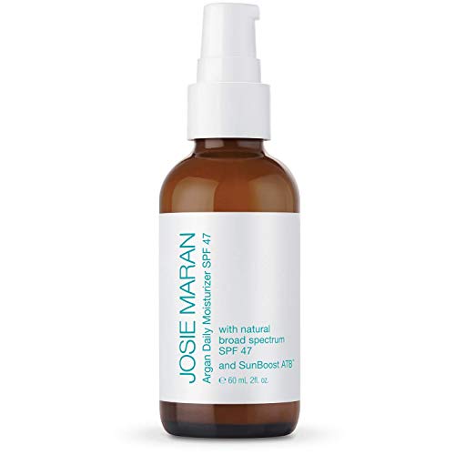
SUNSCREEN- most of this hike is exposed! be sure to bring sunscreen and reapply. My favorite natural sunscreen is Josie Maran’s SPF47
SUNGLASSES & HAT- again, this hike is exposed, make sure you don’t get sun burnt!
LAYERS- It was about 70 degrees during this hike in April, which felt perfect for shorts and a tank, but I was glad to have an extra layer wrapped around my waist.